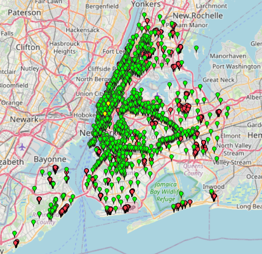
This map provides information about free Wi-Fi locations in NYC.
Data without specific names has been excluded.
The Wi-Fi categories are divided into Fully Free, Limited Free, and Partner Site Wi-Fi.
This map provides information about free Wi-Fi locations in NYC.
Data without specific names has been excluded.
The Wi-Fi categories are divided into Fully Free, Limited Free, and Partner Site Wi-Fi.
About This Map The Tennessee Fatal Crash Map (2020–2024) uses data from the National Highway Traffic Safety Administration (NHTSA). The dataset covers fatal vehicle crashes in Tennessee between 2020 and
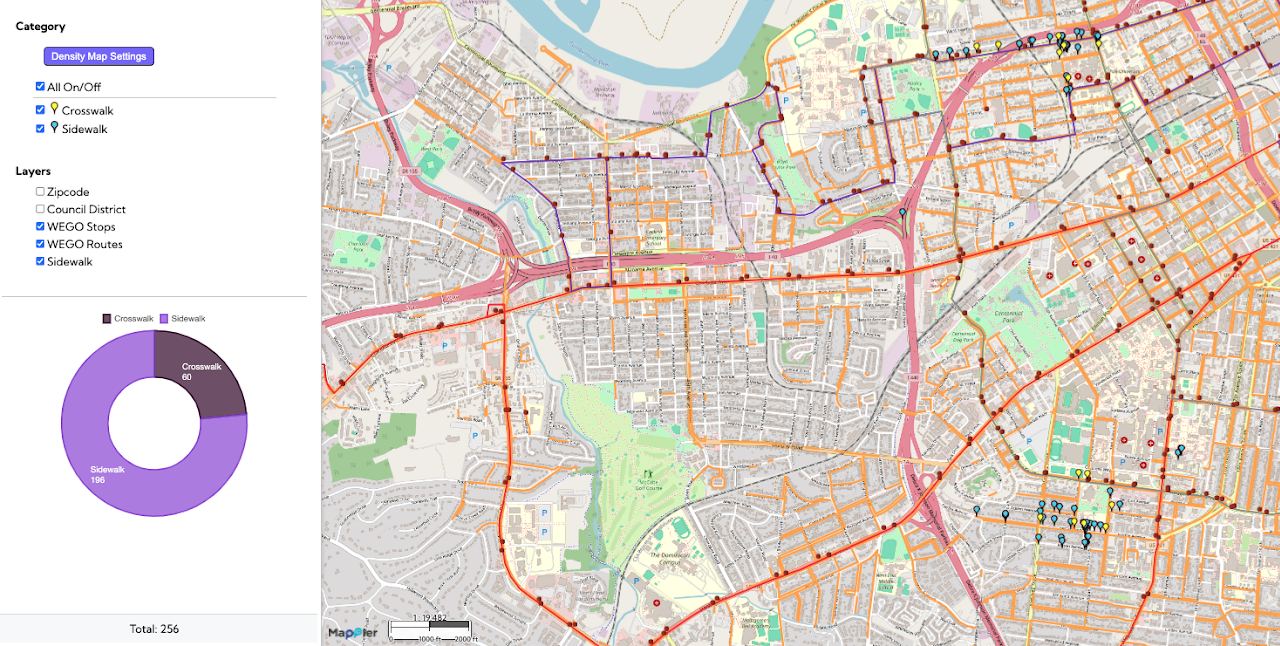
This Safe Routes to School / Pedestrian Safety map visualizes key elements of the walking environment near schools in Nashville, specifically highlighting the locations of sidewalks and crosswalks. By mapping these features alongside
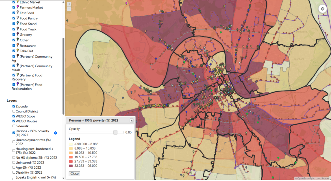
The Nashville Food Resources map, developed with The Nashville Food Project, provides a clear picture of where all food sources are located in the city—from groceries and farmers markets to pantries and