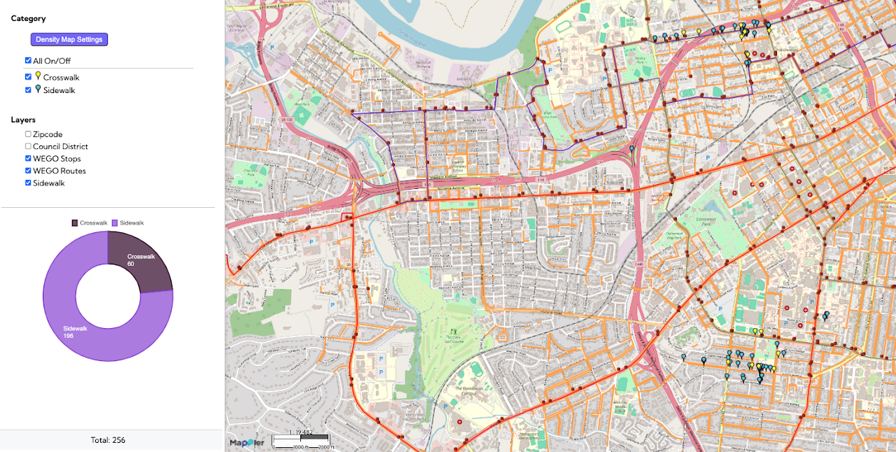
This Safe Routes to School / Pedestrian Safety map visualizes key elements of the walking environment near schools in Nashville, specifically highlighting the locations of sidewalks and crosswalks. By mapping these features alongside school zones, the tool helps to identify critical gaps in pedestrian infrastructure and highlight areas where safety conditions may be compromised. This information is vital for children and families, ensuring they have access to the safest and most reliable routes when traveling to and from school. Ultimately, the map serves as a practical, data-driven resource for city planners and community advocates to support the development of safer transportation and improved pedestrian infrastructure.
Nashville Safe Routes to School

Related Post

Electronics & Metals Drop Off Locations in NYC 2025Electronics & Metals Drop Off Locations in NYC 2025
A list of locations where NYC residents can drop off unwanted electronics and materials such as metal scraps. The locations are categorized by their service hours (whether they are open

Jefferson Street community mappingJefferson Street community mapping
This Jefferson Street community mapping, a Public Interest Technology initiative, provides a detailed visual inventory of properties and land use along the historic Jefferson Street corridor in Nashville. The map

Public Urination in NYC (2010 – 2025)Public Urination in NYC (2010 – 2025)
This map visualizes 311 complaints related to public urination across New York City from 2010 to 2025. The map can be used to identify high-frequency areas, evaluate the effectiveness of