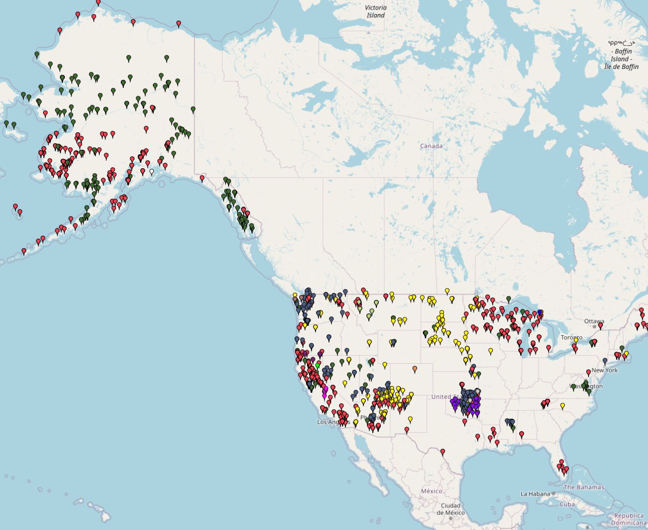
This map displays the geographic distribution of Indian Health Service (IHS) and affiliated health care facilities across the United States, with a prominent concentration in Alaska, the Southwest, and the Northern Plains. The facilities are categorized by type, including tribal, federal, and urban partnerships, as well as variations such as IHS/Tribal compacts and Medicaid agreements.
Indian Health Service Facilities

Related Post

NYC Structural Accident Response Map by Type (2014-2022)NYC Structural Accident Response Map by Type (2014-2022)
This map shows the types of structural accidents and where they occurred in New York City from 2014 to 2022. The incidents are categorized into 8 different types: Collapse, Collision, Construction

Cool It! NYC Location Map 2025Cool It! NYC Location Map 2025
This map presents the locations of public cooling features that provide relief from extreme heat during heat emergencies. The data are categorized by the type of cooling feature available in

Mapping Shooting Incidents: NYC 2025Mapping Shooting Incidents: NYC 2025
This map shows shooting incidents in New York in 2025, up to November 4. You can check when and where shooting incidents occurred and types of victims who were shot. The