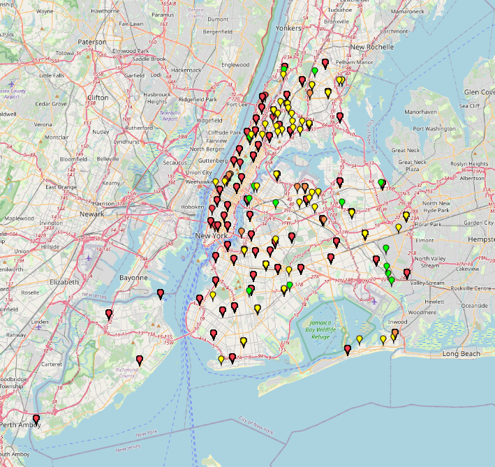
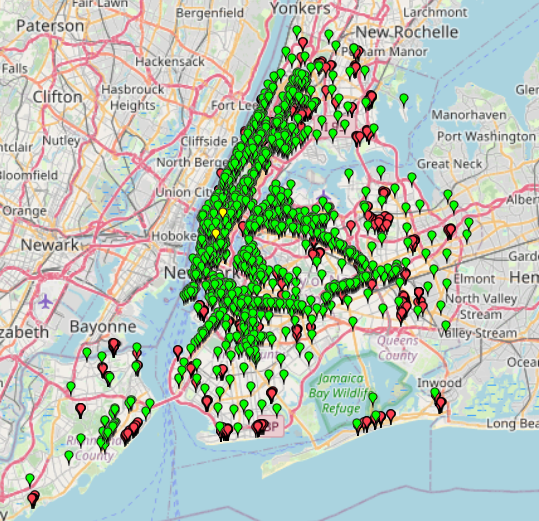
“NYC Juvenile Offenses:Crime Mapping by Type” is a map based on NYPD Arrest Data 2025 data in New York City. It visualizes child abuse, abandonment, luring and sexual offenses by crime
Category: NYC
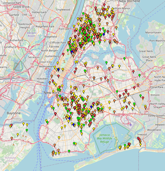
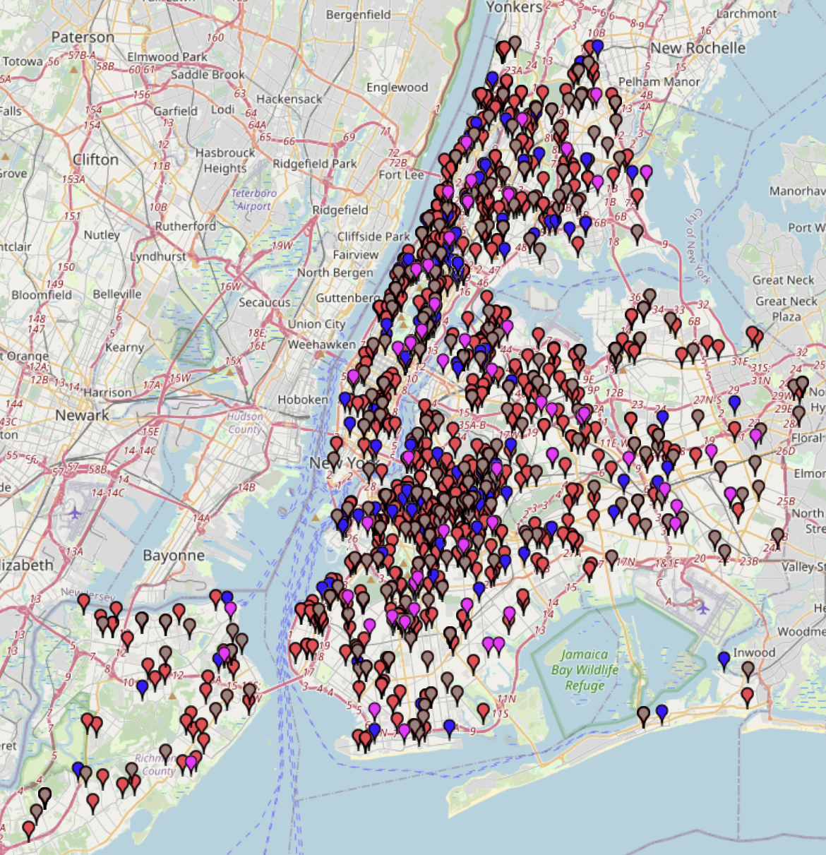
NYC Structural Accident Response Map by Type (2014-2022)NYC Structural Accident Response Map by Type (2014-2022)
This map shows the types of structural accidents and where they occurred in New York City from 2014 to 2022. The incidents are categorized into 8 different types: Collapse, Collision, Construction
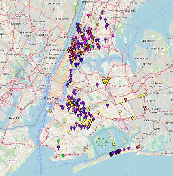
Electronics & Metals Drop Off Locations in NYC 2025Electronics & Metals Drop Off Locations in NYC 2025
A list of locations where NYC residents can drop off unwanted electronics and materials such as metal scraps. The locations are categorized by their service hours (whether they are open
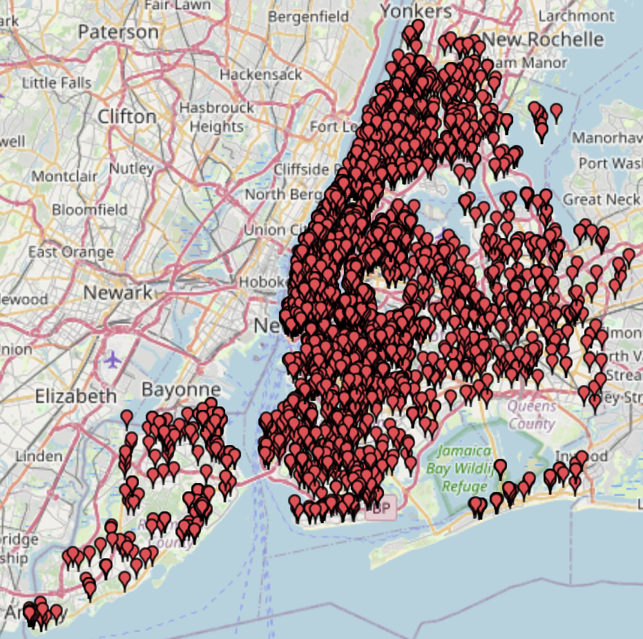
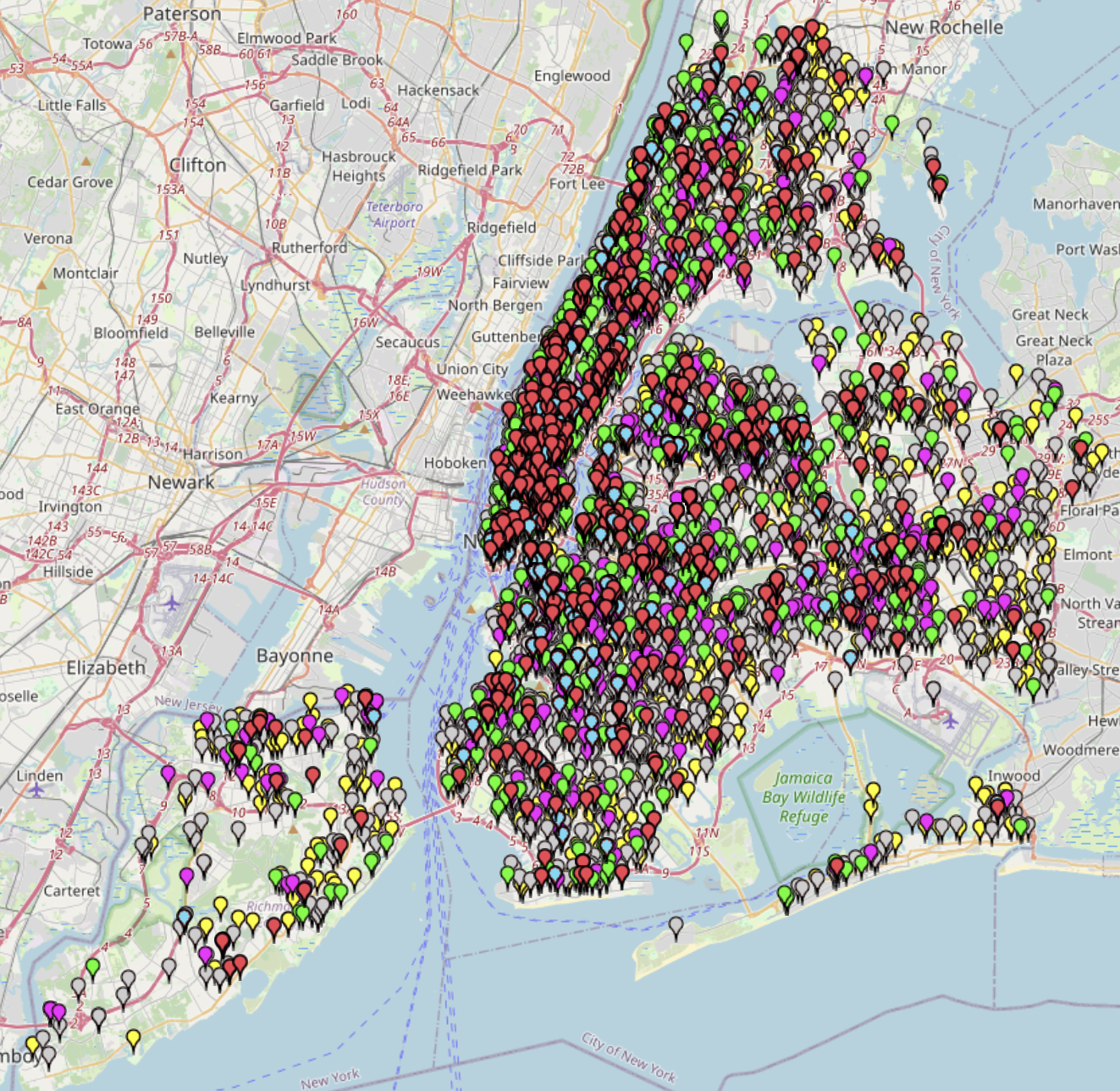
New York’s Fire Hotspots by Alarm Level (2014–2022)New York’s Fire Hotspots by Alarm Level (2014–2022)
This map shows fire response incidents in New York from 2014 to May 2022. You can see when and where fires occurred, as well as the types of alarm levels
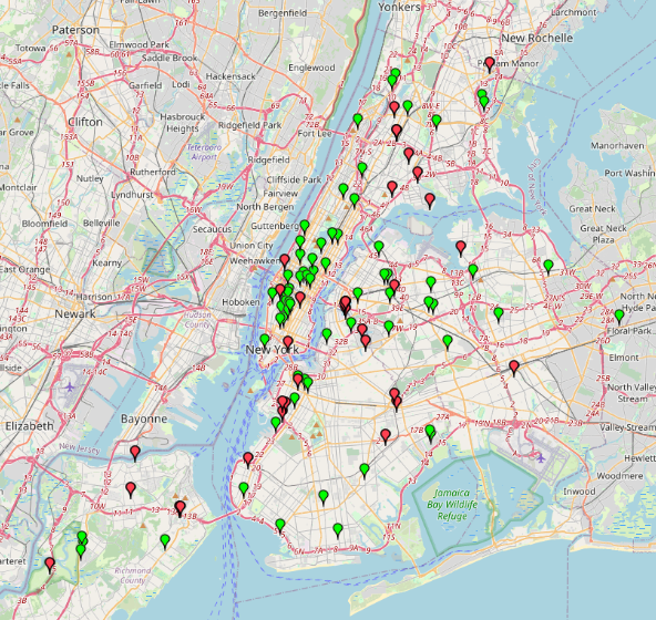
NYC Free Wi-Fi Map 2025NYC Free Wi-Fi Map 2025
This map provides information about free Wi-Fi locations in NYC. Data without specific names has been excluded. The Wi-Fi categories are divided into Fully Free, Limited Free, and Partner Site
Cool It! NYC Location Map 2025Cool It! NYC Location Map 2025
This map presents the locations of public cooling features that provide relief from extreme heat during heat emergencies. The data are categorized by the type of cooling feature available in
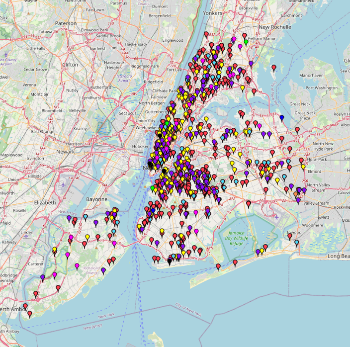
Mapping Shooting Incidents: NYC 2025Mapping Shooting Incidents: NYC 2025
This map shows shooting incidents in New York in 2025, up to November 4. You can check when and where shooting incidents occurred and types of victims who were shot. The
Noise Complaints in NYC June 2025Noise Complaints in NYC June 2025
This map displays 311 noise complaints reported across New York City during June 2025. The data captures various types of noise disturbances—including loud music, parties, construction, and street noise—submitted by
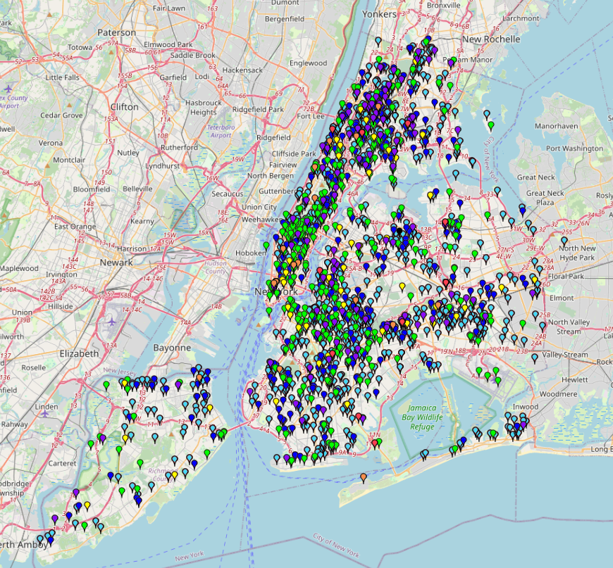
NYC Rodent (Mouse) Complaints (1/1/2025-7/17/2025)NYC Rodent (Mouse) Complaints (1/1/2025-7/17/2025)
This dataset captures 311 service requests related specifically to rodent activity reported by New York City residents between July 2 and July 17, 2025.This data offers insight into spatial and
Public Urination in NYC (2010 – 2025)Public Urination in NYC (2010 – 2025)
This map visualizes 311 complaints related to public urination across New York City from 2010 to 2025. The map can be used to identify high-frequency areas, evaluate the effectiveness of