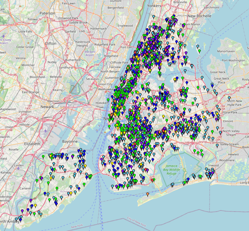
This map shows fire response incidents in New York from 2014 to May 2022. You can see when and where fires occurred, as well as the types of alarm levels
Day: November 13, 2025
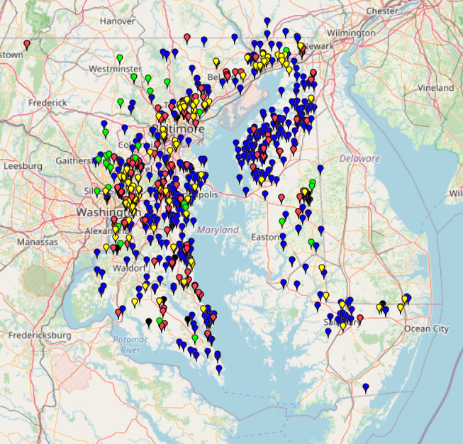
Chesapeake Watershed Fish Passage RestorationChesapeake Watershed Fish Passage Restoration
This map shows the Fish Blockage Locations around the Chesapeake Watershed. The categories are divided into four types of fish blockages: Dam, Culvert, Weir, and others. Data without latitude and longitude
NYC Free Wi-Fi Map 2025NYC Free Wi-Fi Map 2025
This map provides information about free Wi-Fi locations in NYC. Data without specific names has been excluded. The Wi-Fi categories are divided into Fully Free, Limited Free, and Partner Site
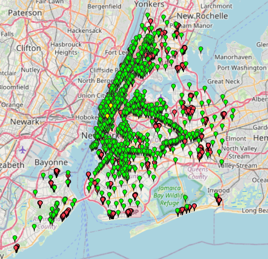
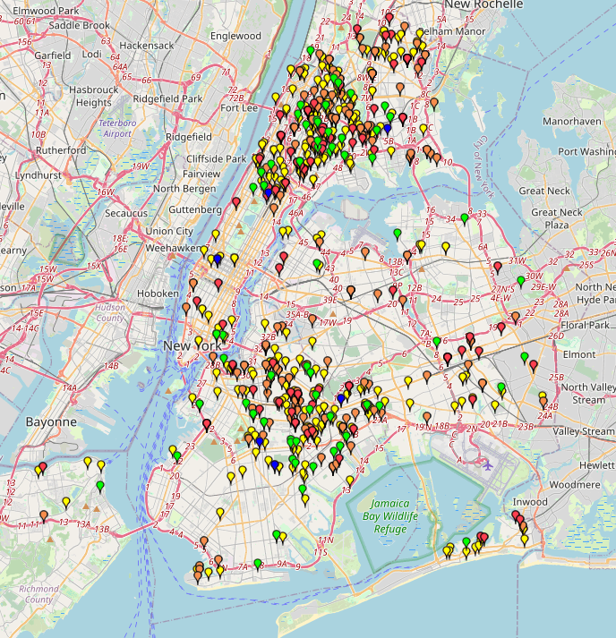
Cool It! NYC Location Map 2025Cool It! NYC Location Map 2025
This map presents the locations of public cooling features that provide relief from extreme heat during heat emergencies. The data are categorized by the type of cooling feature available in
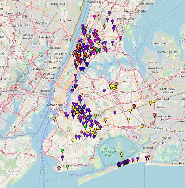
Mapping Shooting Incidents: NYC 2025Mapping Shooting Incidents: NYC 2025
This map shows shooting incidents in New York in 2025, up to November 4. You can check when and where shooting incidents occurred and types of victims who were shot. The