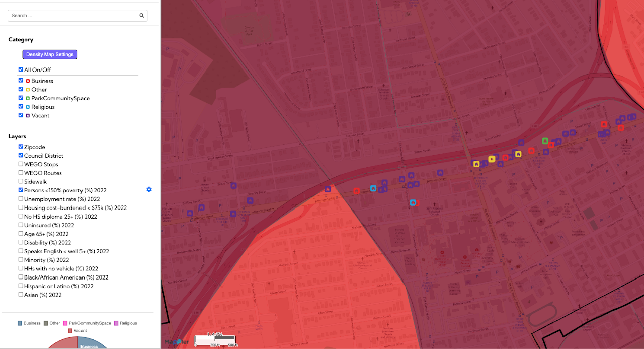
This Jefferson Street community mapping, a Public Interest Technology initiative, provides a detailed visual inventory of properties and land use along the historic Jefferson Street corridor in Nashville. The map
Day: January 12, 2026
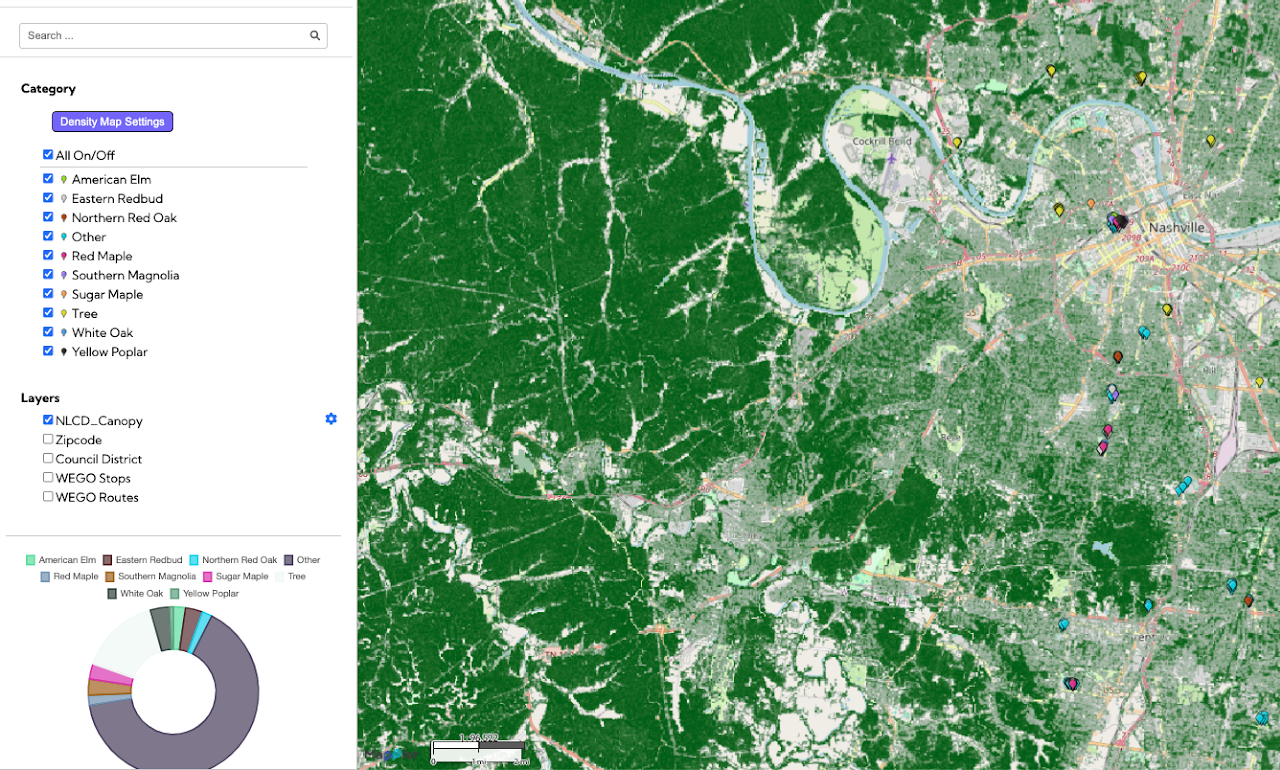
Nashville Tree MappingNashville Tree Mapping
This Nashville Tree Mapping project, a Public Interest Technology initiative, provides a detailed geographic record of trees and green spaces within a specified urban area of Nashville. By visualizing the location and presumably the
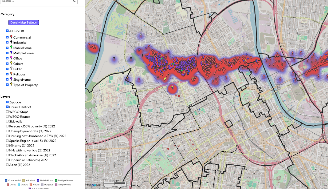
Post Assesment of Nashville Tornado 2020Post Assesment of Nashville Tornado 2020
The Nashville Tornado 2020 Post-Assessment map provides a detailed geographic record of property conditions following the devastating 2020 tornado. This initiative tracks vital recovery metrics, categorizing locations as rebuilt, renovated, repaired, or demolished, while
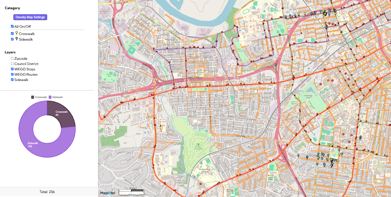
Nashville Safe Routes to SchoolNashville Safe Routes to School
This Safe Routes to School / Pedestrian Safety map visualizes key elements of the walking environment near schools in Nashville, specifically highlighting the locations of sidewalks and crosswalks. By mapping these features alongside
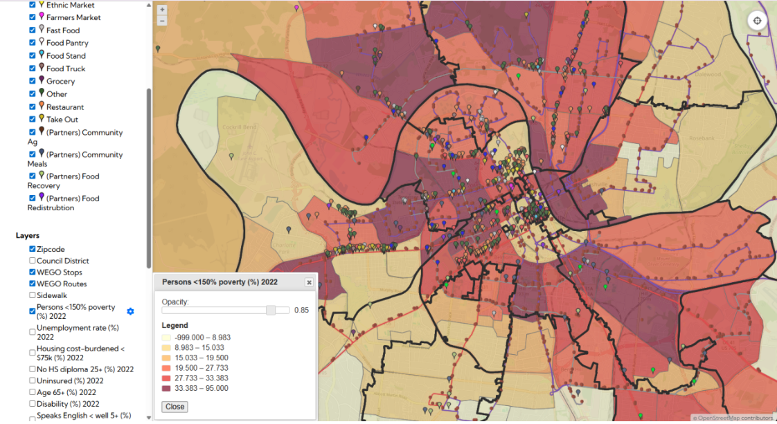
Nashville Food Resources MapNashville Food Resources Map
The Nashville Food Resources map, developed with The Nashville Food Project, provides a clear picture of where all food sources are located in the city—from groceries and farmers markets to pantries and